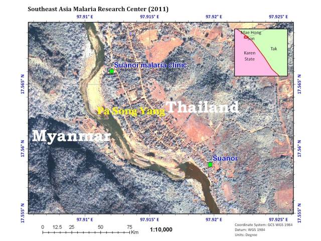
 Figure 1: Satellite image of study areas in Thai/Myanmar border (Tha Song Yang, Tak, Thailand)
Because this ICEMR project utilizes new sites that have not been studied before, we acquired 1 meter resolution IKONOS
satellite images for the study areas in Tak province in Thai-Myanmar border area and in China/Myanmar border areas.
The entomological study sites are also the sites where we conduct active malaria case surveillance. Fig. 1 is an
example of satellite image of the study areas in Thai/Myanmar border. We also prepare the basic information
such as river, stream, road, rail road, administration boundary, or locations from goverment agency and scaned paper maps.
From satellite image and through ground truthing, we are developing detailed land-use land-cover maps for the study sites.
The maps with detailed environmental parameters are extremely valuable for sampling site determination and for quantifying the
impact of environmental changes on vector species composition. Environmental changes will be quantified from satellite images
taken at various time points and by ground survey. We prepare the detail maps for our researchers and field assistants to
identify the location of the enrolled study subjects. We have identified 9 villages in Myanmar (Fig. 3) and 8 villages in
Thailand (Fig. 4) for active surveillance.
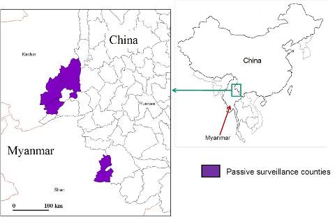 Figure 2: The sites for Active and Passive malaria surveillance study
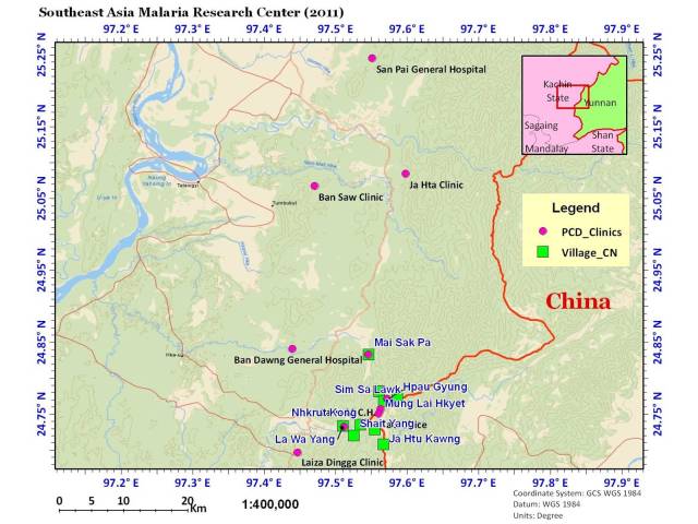 Figure 3: Distribution of study sites of active malaria surveillance (green square) and passive case detection (red dot) in China/Myanmar border
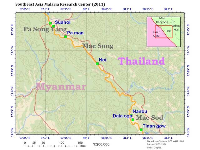 Figure 4: Distribution of study sites of active malaria surveillance (green square) and passive case detection (red dot) in Myanmar/Thailand border